 Description
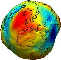
GDAL/OGR is widely used in open source and closed source applications. The OGRSpatialReference in conjunction with the PROJ.4 library is quasi standard for 2D coordinate transformation. Although, 3D transformations are - to some extend - supported within the library, the implemented solution is unsatisfactory from a geodetic point of view. The objective is to establish a rigorous 3D transformation chain, to support Vertical Datum definitions in a generic way.
Benefit for the Student
Gain a deep understanding of world- and countrywide coordinate systems and their transformation. Conceive definition issues of horizontal and height systems on the earth. Being part of a small but widely used open source project.
Benefit for the Project
Set an appropriate standard for 3D transformations for subsequent projects.
Requirements
General understanding of geocentric and geographic coordinate systems, map projection and coordinate transformation is essential. Solid skills in C/C++ and understanding of existing code are necessary. Source code version management experiences (git, github) are welcome.
Mentors
Gottfried Mandlburger, Johannes Otepka
Contact
Mentors are regularly around in our GSoC IRC channel #TU-CSE-SoC at irc.freenode.net. You can also reach us via the mailinglist – send an email to This email address is being protected from spambots. You need JavaScript enabled to view it. using the prefix [GDAL] (a subscription is required).
More information
http://www.iue.tuwien.ac.at/cse/wiki/doku.php?id=wiki:projects:gdal-vertical-datums